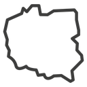
England Country Map black outline icon


Outlined map silhouette of England showing its coastline and borders
Related tags
About the England Country Map black outline icon
The full national outline of England, traced with its ragged coastline: the wide northern border, the East Anglian bulge on the right, the Thames estuary notch and the long south-western peninsula reaching left. It carries ideas of country, territory, nationality and location, and suits travel sites, shipping and delivery zone pages, election or census graphics, school geography slides and store locators.
The contour is a single closed stroke with no internal counties or cities, so it reads as a clean silhouette at any size and can be filled with a flag or pattern. It pairs with other country map icons and with pin, globe and flag glyphs; below 32 px the coastal detail turns to noise.
This is the black outline version of the england country map icon: even, monoline strokes that stay crisp at small sizes and suit clean, minimal interfaces, wireframes and light backgrounds.
Download it free as a scalable SVG vector or transparent-background PNG in seven sizes (16 to 512px), copy the SVG code straight into your project, or open it in the free online editor to change colors, apply gold, silver, neon and gradient styles, animate it, or convert it to EPS, PDF and DXF.
Free for personal and commercial use with attribution.