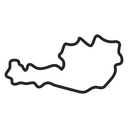
Austria Country Map black outline icon


Map of Austria showing its national border, drawn inside a circular frame
About the Austria Country Map black outline icon
The territory of Austria fills a thin circular frame, its jagged borders narrowing to a long western tail and widening toward the broader eastern end. Recognizable at a glance, it works for travel booking sites, geography lessons, shipping and coverage maps, country selectors in forms and news graphics about central Europe.
Only the national border is drawn, with no cities or rivers, which keeps the shape clean at small sizes. It matches other European country maps in the library; when used as a selector, keep the surrounding circle so every flag or map aligns the same way.
This is the black outline version of the austria country map icon: even, monoline strokes that stay crisp at small sizes and suit clean, minimal interfaces, wireframes and light backgrounds.
Download it free as a scalable SVG vector or transparent-background PNG in seven sizes (16 to 512px), copy the SVG code straight into your project, or open it in the free online editor to change colors, apply gold, silver, neon and gradient styles, animate it, or convert it to EPS, PDF and DXF.
Free for personal and commercial use with attribution.