
Texas black filled icon


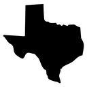
Outline map of the state of Texas showing panhandle and gulf coast borders
About the Texas black filled icon
The recognizable border of Texas is traced as a single closed contour: the square panhandle at the top left, the straight western edge, the winding river boundary along the south and the curving gulf coastline to the southeast. It works for United States map collections, state selector menus, travel and relocation sites, local business listings, election or census dashboards and regional presentation slides.
The silhouette is drawn as a clean outline with softened corners so the shape stays readable without internal detail or city markers. It matches the other fifty state outlines in the library for building a full US set. Place a pin or label beside it, and use at 48 px or larger so the panhandle notch remains clear.
This is the solid black filled version of the texas icon: a bold silhouette that reads clearly at 16-24 px and on dark or busy backgrounds, and prints well in one colour.
Get it free as an SVG vector or transparent PNG (16-512px), copy the SVG code, or restyle it in the free online editor — recolor any part, add gold, neon or gradient effects, animate it, or export EPS, PDF and DXF.
Free for personal and commercial use with attribution.