Luxembourg Country Map black filled icon

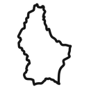

Outline map of Luxembourg showing the country's national border shape
Related tags
About the Luxembourg Country Map black filled icon
The national outline of Luxembourg drawn as a single closed contour, keeping the narrow northern tip, the jagged western border and the pointed southeast corner that make the country recognizable. It marks country selection, service coverage and location context in travel sites, logistics and shipping pages, language pickers, data maps and school geography material.
The shape is much taller than it is wide, so it aligns well in a column of European country outlines from the library. Border detail is simplified but keeps the distinctive notches. Below 32 px, switch to the filled version, as the thin contour tends to close up.
This is the solid black filled version of the luxembourg country map icon: a bold silhouette that reads clearly at 16-24 px and on dark or busy backgrounds, and prints well in one colour.
Get it free as an SVG vector or transparent PNG (16-512px), copy the SVG code, or restyle it in the free online editor — recolor any part, add gold, neon or gradient effects, animate it, or export EPS, PDF and DXF.
Free for personal and commercial use with attribution.